
Flying to the northernmost airport in Sweden to spend 8 days on the beautiful Kungsleden and hike from Nikkaluokta to Abisko. When the conditions allow it, climb Kebnekaise, the highest mountain in Sweden. To my friends and I, this sounded like a great plan. Enjoy this report of my favourite hiking adventure so far.
In a nutshell
| Type of hike | From A to B (no roundtrip) |
| Start – Finish | Nikkaluokta – Abisko |
| Duration | 8 days |
| Distance | 119 km |
| Distance per day | 18 km – 17 km – 14 km – 12 km – 14km – 15 km – 16 km – 13 km |
| Elevation per day | [+283 -85] – [+1806 -1806] – [+293 -281] – [+236 -92] – [+293 -275] – [+156 -268] – [+101 -393] – [+58 -175] |
| Time of year | End of July |
| Location | Swedish Lapland |
Video
Report
Before the hike
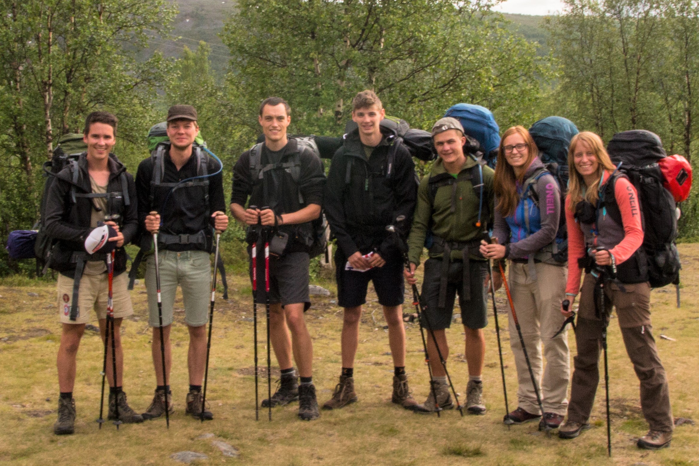
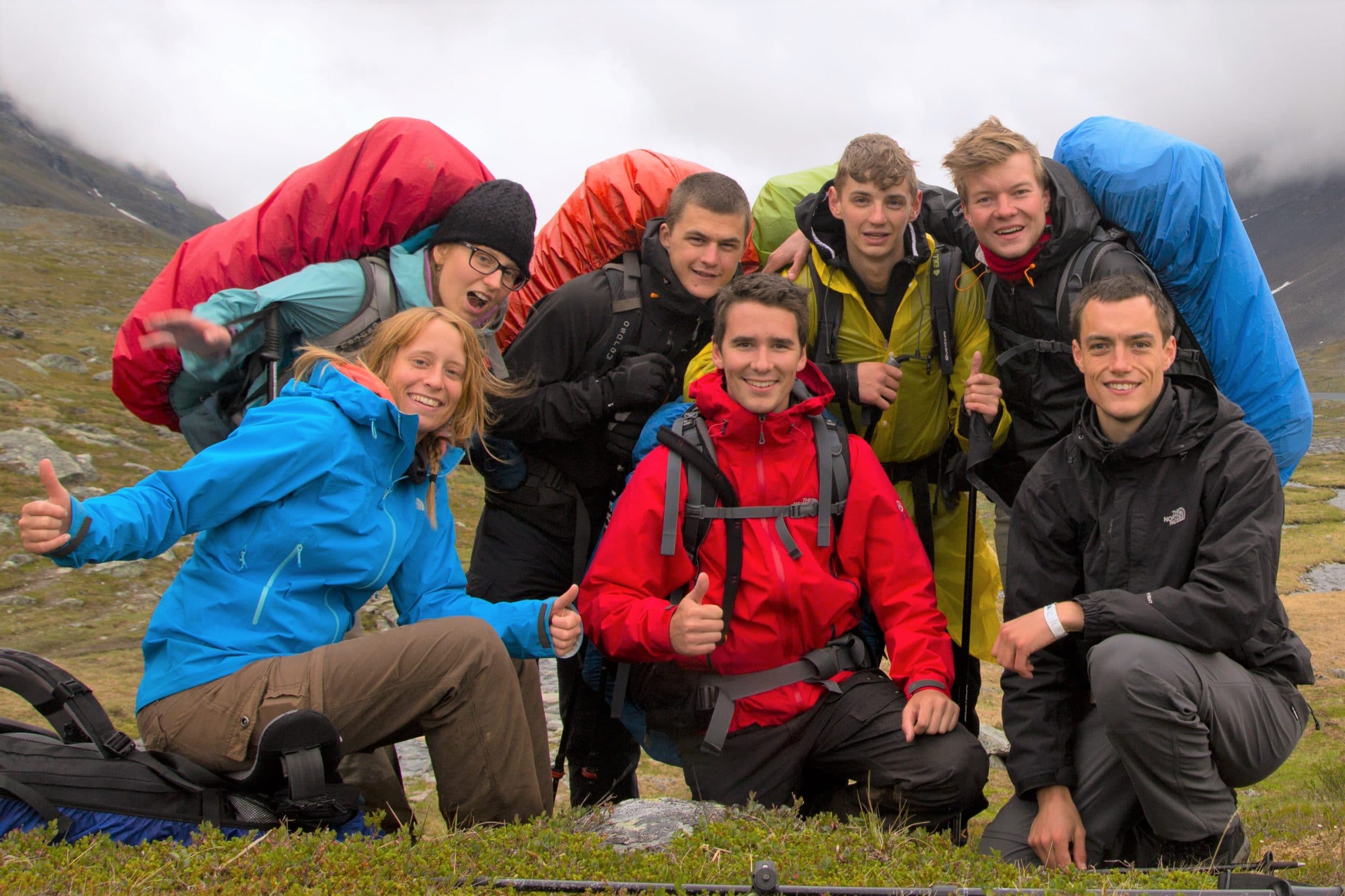
On the 23rd of July we met with a group of seven friends in Leuven, ready for an adventure. After some last minute gear checks and backpack-weight-comparisons, we took the train to Brussels Airport. We drank our last Belgian beer (you know, for a safe flight.. never mess with traditions) and got on our flight to Bromma Stockholm Airport.
We arrived in the afternoon and had our next flight planned for early next morning. So this gave us some free time and we decided to go and discover Stockholm city for a couple of hours. When the evening came, it was time to go to Stockholm Arlanda Airport. From here, we had a flight the next day that would take us to Kiruna, the northernmost airport in Sweden. Our plan was to look for a sleeping spot inside the airport. We found a great place (next to a bar), played some games, got some ice cream and beer, rolled out our sleeping bags and had a good night.
The next morning we were woken early by the first travellers of the day. I woke up a few meters from a guy who seemed equipped for a hike. We talked and he had just finished the trek we were planning to do. There was still a lot of snow on the trail, he told us, and he gave us a pot of Nutella. When we got on the (very small) airplane, it quickly became clear there was a certain kind of people flying to Kiruna. Hiking boots, pants and backpacks everywhere!
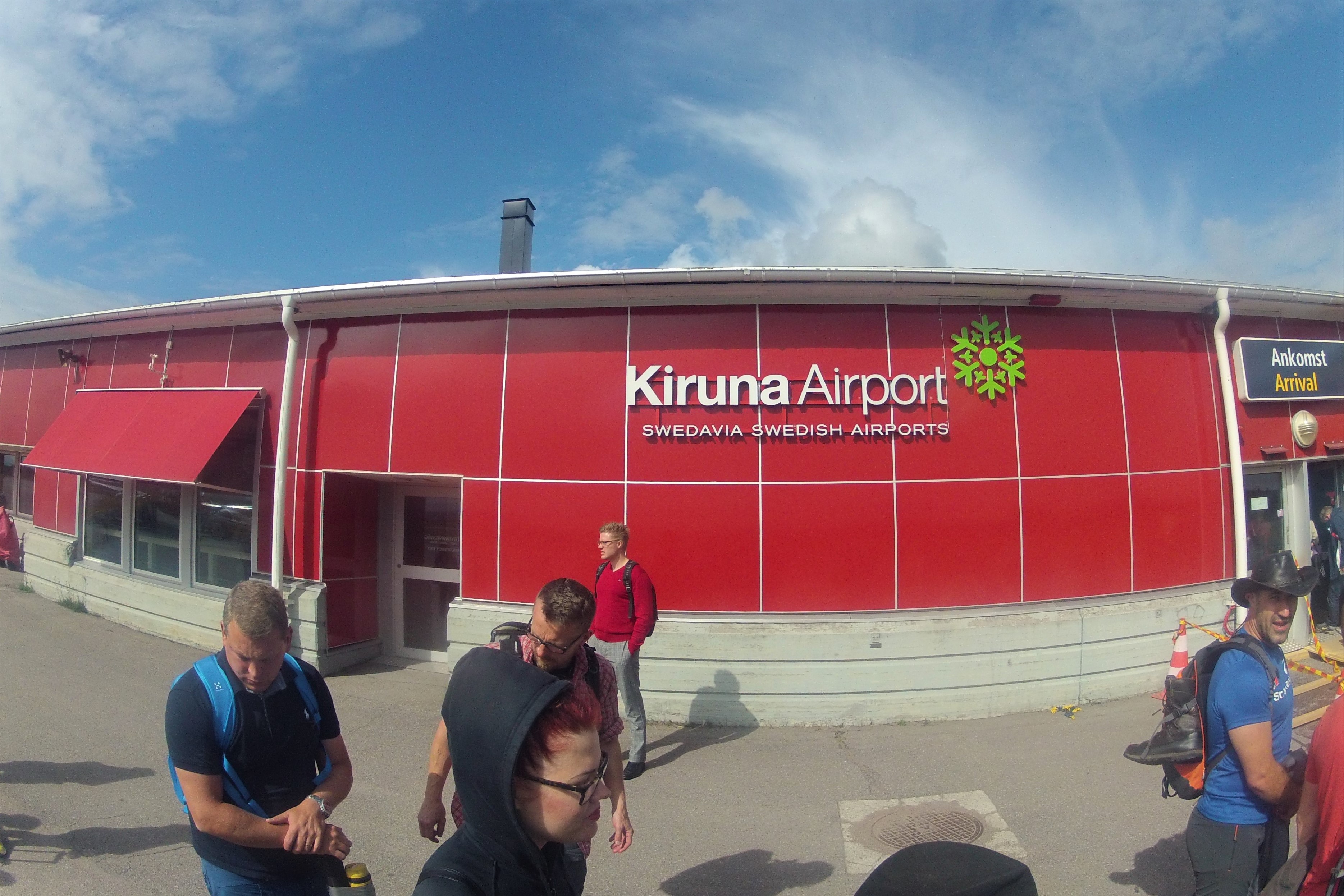
After an hour and a half, we arrived at the smallest airport I had ever seen. You go in on one side, grab your pack, and leave on the other side. Then we took the bus to the center of Kiruna. Close to the bus station was a store where we bought our last good meal. Then we took the last bus, straight to Nikkaluokta, the starting point of our hike.
Day 1 (Nikkaluokta – Kebnekaise Fjällstation)
In Nikkaluokta, we visited the information center, filled up our hydration bladders and of we went! After five kilometres, there was the option to take a little boat and by doing so, skip a bit of the trail. Because it was already late and we wanted to arrive on time at the mountain station (Fjällstation), we decided to take the boat. It was not cheap but once we were on it, this was soon forgotten. The friendly captain asked us if we wanted to sit on the front deck of his boat for a better view. This was truly amazing and a beautiful start of our adventure.
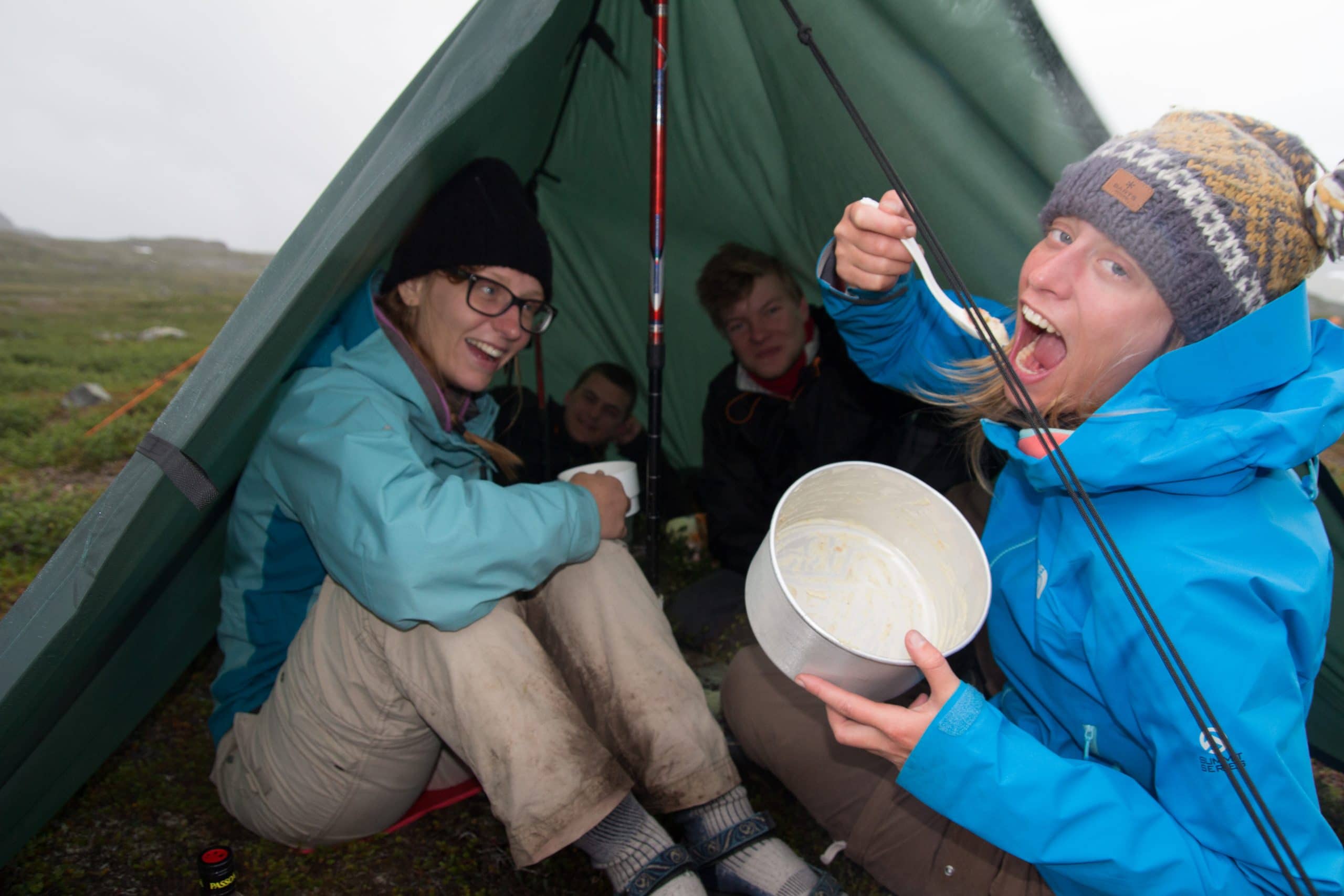
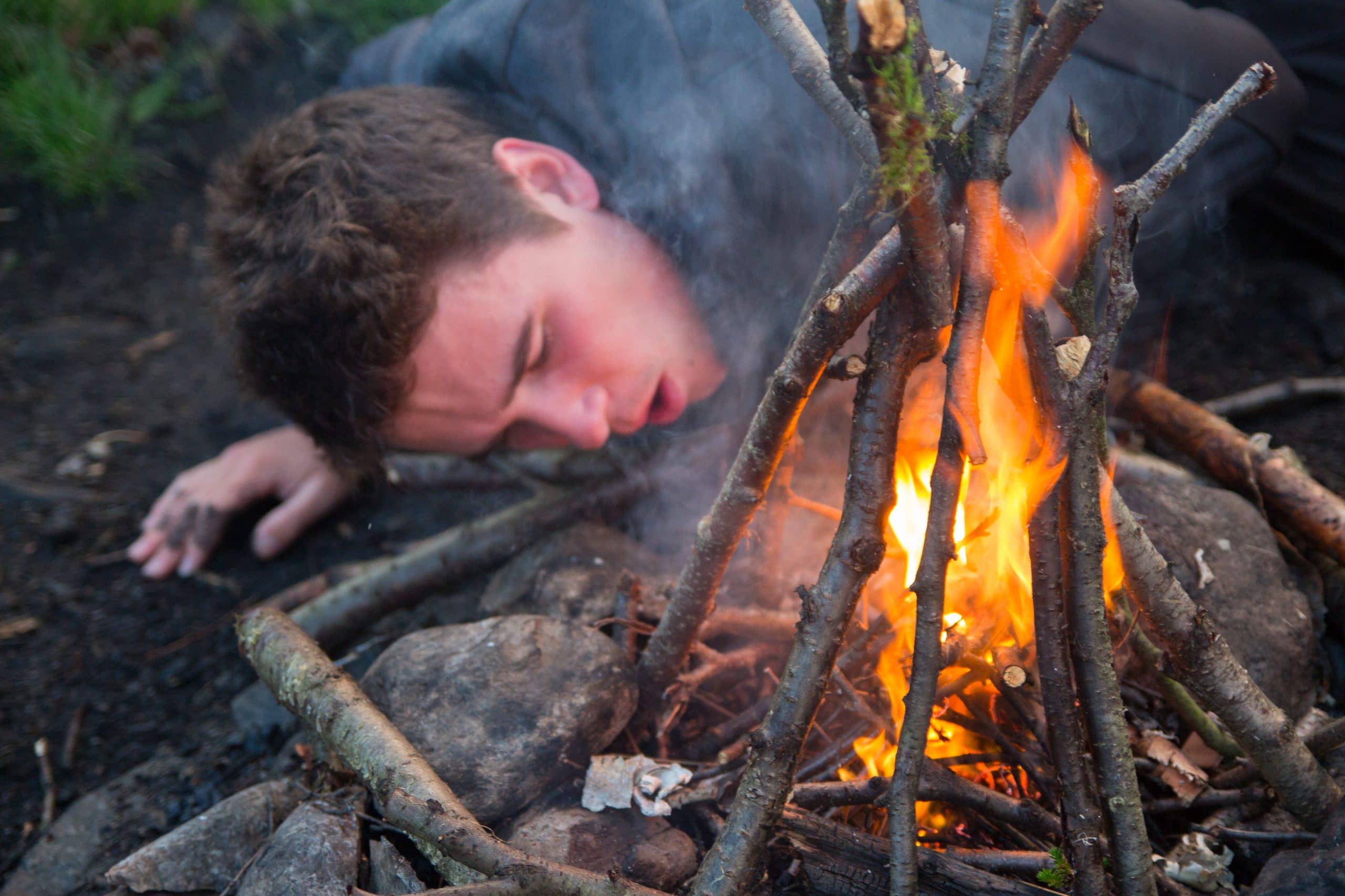
When the boat stopped we said goodbye and continued towards the mountain station. After eight kilometres, we arrived at the station. The weather had turned, so we quickly put up our tents and tarp. The tarp had once before been in Sweden and was used as a group shelter for dinner or a late night cup of tea. We soon discovered that when a cup of tea became a late night cup of tea was only determined by the time on your watch. Because we were so high up north, during that time of year, it never truly got dark.
Day 2 (Kebnekaise Fjällstation – Kebnekaise – Kebnekaise Fjällstation)
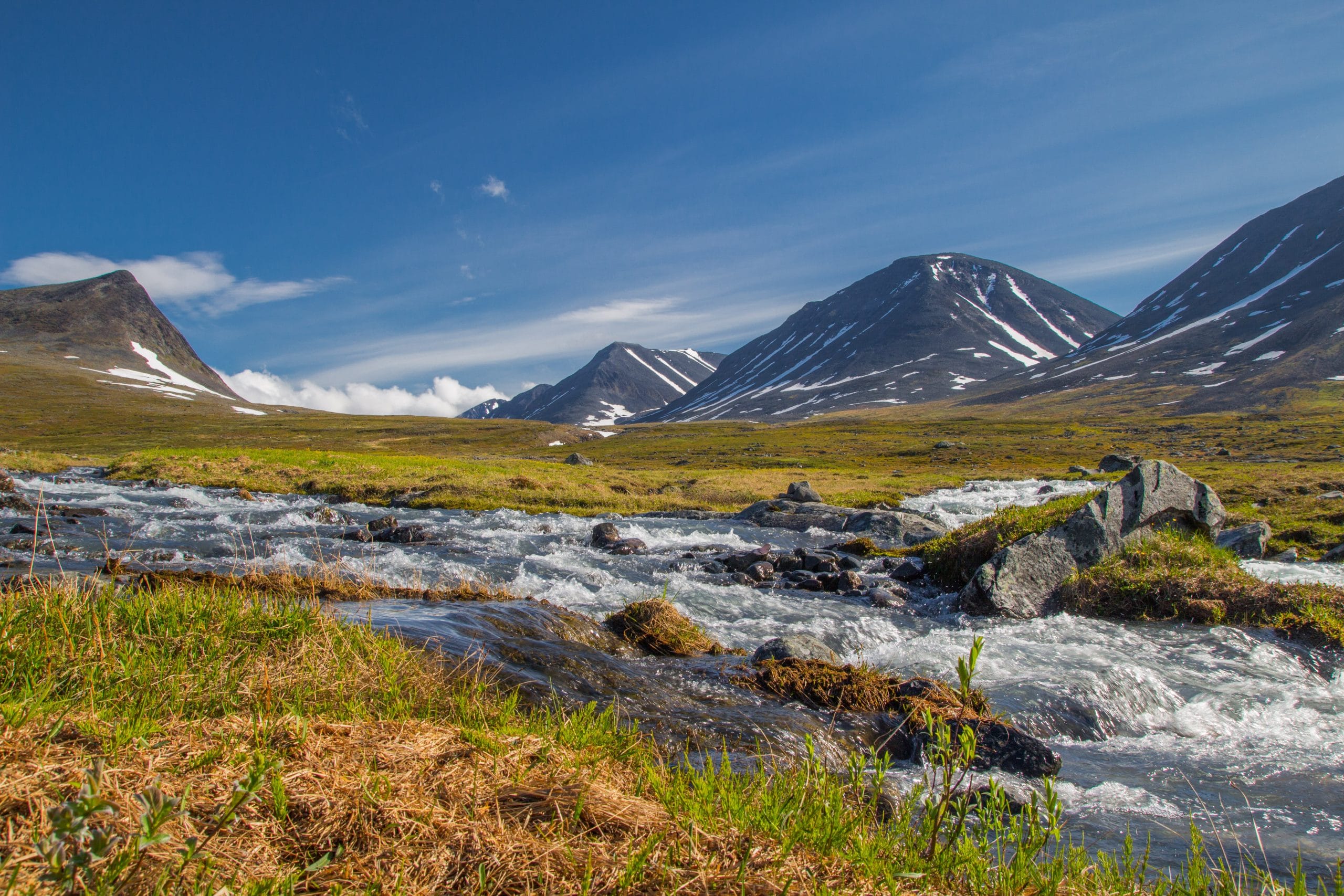
The next morning, the alarm went off at 5:30. The goal for that day was climbing Kebnekaise, with its 2106 metres, the highest mountain in Sweden. There are two possible routes to the top: the Östra leden (east route) and the Västra leden (west route). The east route can, when the conditions allow it, be done without special equipment and is fairly easy but long. The shorter east route crosses a glacier and requires technical knowledge and/or a guide. None of us had any mountaineering experience at that time, so we chose the Västra leden.
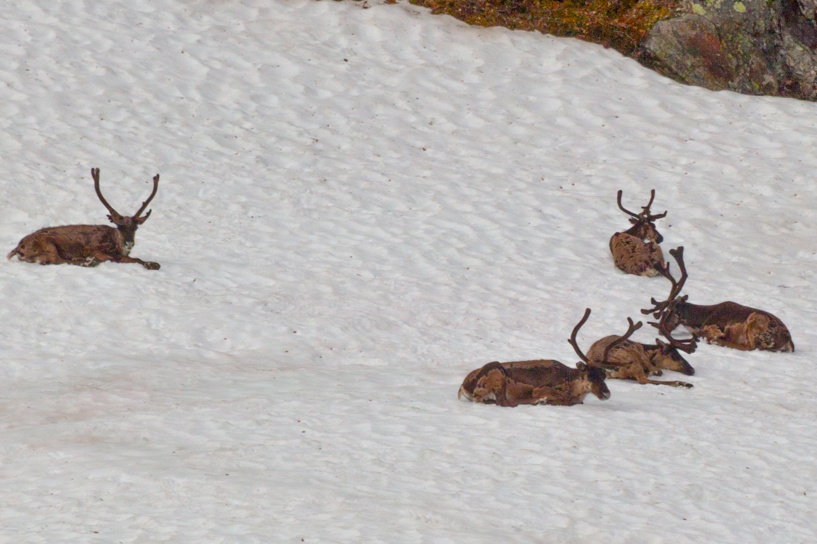
We first followed the main valley and then climbed up to a side valley where we saw a group of reindeers. Here we crossed a bridge an continued climbing up into a saddle between Duolbagorni and Vierranvárri. From there the path led us up to the Vierranvárri where we were greeted by a lot of cairns (human-made piles of stones). We descended down the other side of Vierranvárri into another saddle. From here, we started the actual ascent of Kebnekaise.
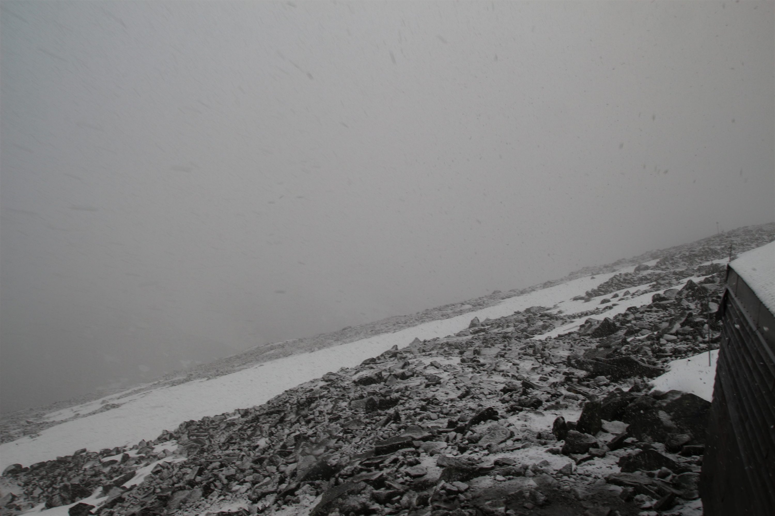
So far, the weather had been shifting between sun, rain and hail. When climbing up, it also started to snow. One kilometre from the top, there was a small emergency shelter (Kebnekaises nya toppstuga) and we decided to take a break there and discuss whether we would continue to the top in this weather or not.
The shelter was packed with people, everyone was waiting to see what the weather would do. After some rest we discussed our options and decided as a group to go back down because it only started snowing more and we were not very experienced in these type of conditions.
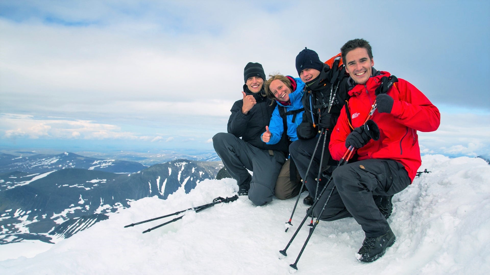
After descending for 15 minutes the weather suddenly started clearing up. We stopped and re-evaluated our decision. A part of the group decided it had been enough for the day and continued down to the mountain station. Four of us turned around and went for the top. The weather was getting better and better and during the final minutes of our ascent, everything cleared up.
The last few meters were amazing and there was just enough room on the top for the four of us. After enjoying the view and taking some photos, we began our descend. Many people from the shelter were also making their way up to the top now. We used some shortcuts sliding through the snow and at 20:30, we arrived back at the mountain station.
Day 3 (Kebnekaise Fjällstation – Singi Fjällstuga)
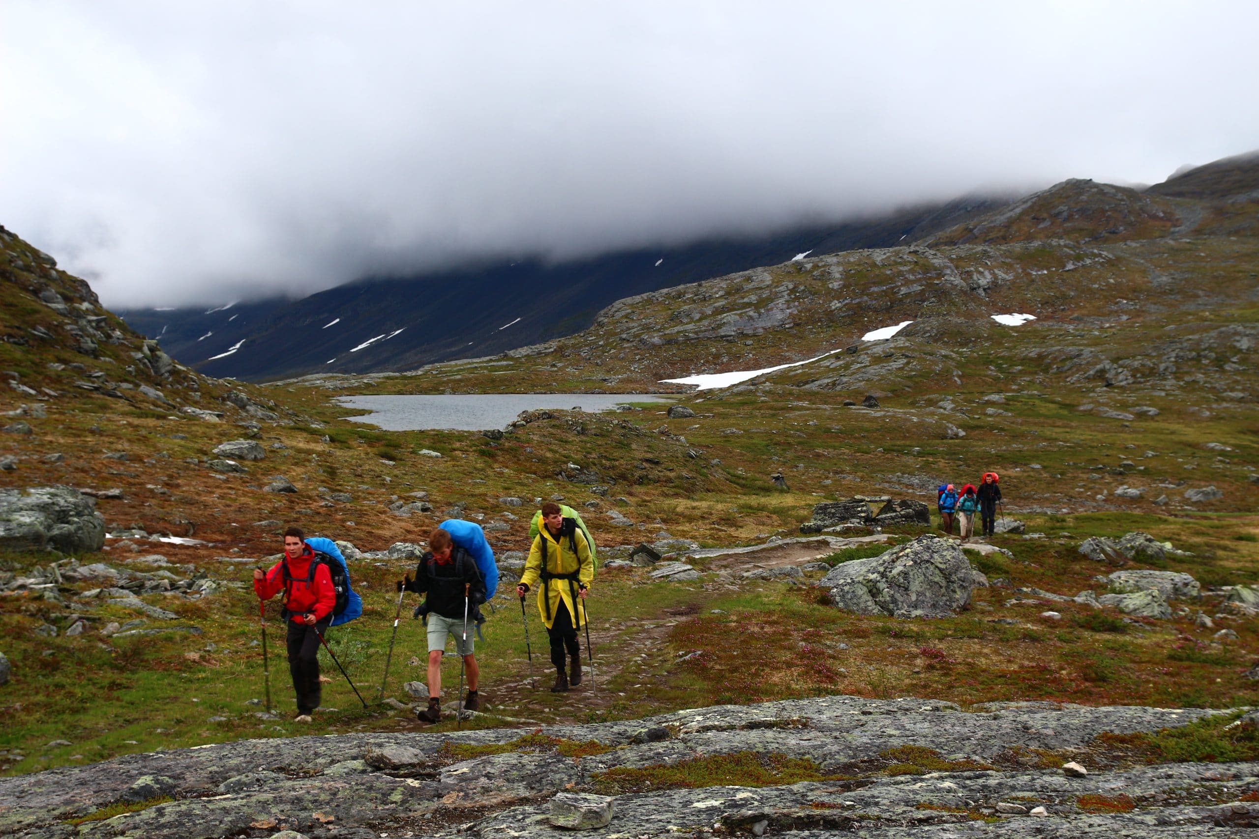
The hike from the mountain station to Singi was fairly straightforward. After 12 kilometres, the valley we had been hiking through since Nikkaluokta, connected to a bigger valley. We saw the Singi mountain hut an made our way down quickly. The weather was turning again and we just managed to put up the tents before it started raining.
I also put up the tarp again and this time I used a different setup to provide maximum protection from the wind and the rain. We cooked in two groups under the tarp and had a fun night, despite the weather. That night the wind was very strong. The other tents needed big stones to keep the stakes in the ground. I had used my trusted MSR Groundhogs and once again, they had proven to do their job.
Day 4 (Singi Fjällstuga – Sälka Fjällstuga)
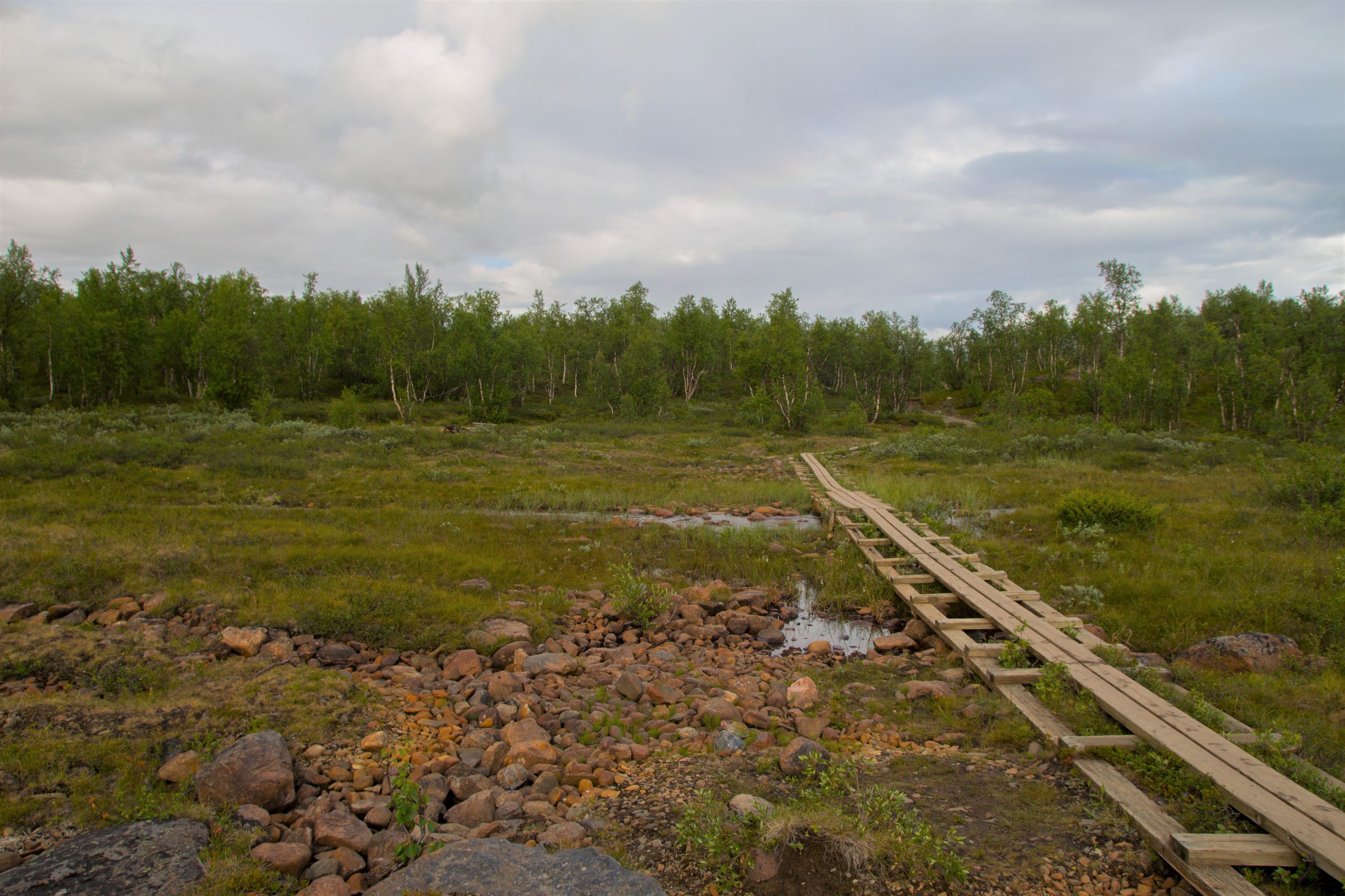
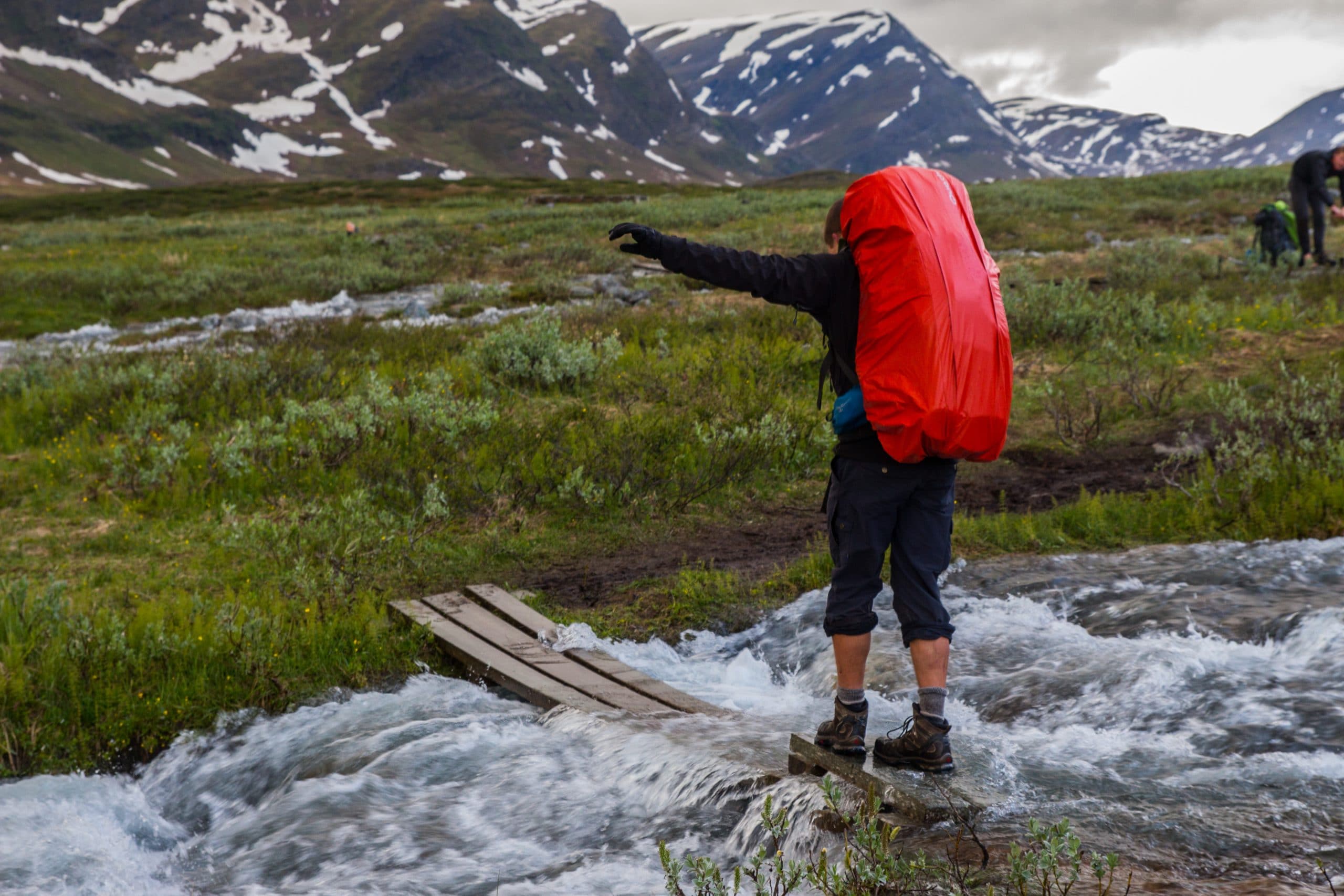
The weather was quiet miserable when we woke up and due to heavy rainfall, the water level in the streams had gone up. We started hiking and crossed a couple of streams. Some of them were equipped with a foot bridge, others were not. I was very happy that I had my water shoes.
After two kilometres, we reached a bridge that went over the main river in the valley. We didn’t have to cross it but went to take a look. A very wild river passing down beneath us in a canyon, an impressive sight. The next kilometre, we discussed the chance of survival when someone would fall of that bridge, I thought very low to non-existent.
Three kilometres later we came across a small cabin (Kuoperjakke) and went inside to eat our lunch. There was an old Asian man with a book full of photos from all his previous trips to Sweden. We couldn’t understand a word he said, but he was a cool guy.
After our lunch, the weather started clearing up and we continued our way to the Sälka Fjällstuga. The cabins in Sälka were bathing in the evening sun when we arrived. We put up our tent next to a small stream, a real idyllic camping spot.
As if this wasn’t enough, there was also a sauna! The sauna had timeslots for mixed, men only and women only. After some time getting warmed up, we ran outside for a quick dip in the ice cold river. Water for the sauna had to be collected with a bucket from the river. Wood for the stove was outside.
After our visit to the sauna, we went to the little shop inside the mountain hut for some food and a beer.
Day 5 (Sälka Fjällstuga – Tjäktja area)
When we woke up the next day, the weather was beautiful! We enjoyed our breakfast, Bert washed his hair in the river and we left. The day started with long wooden fast trails.
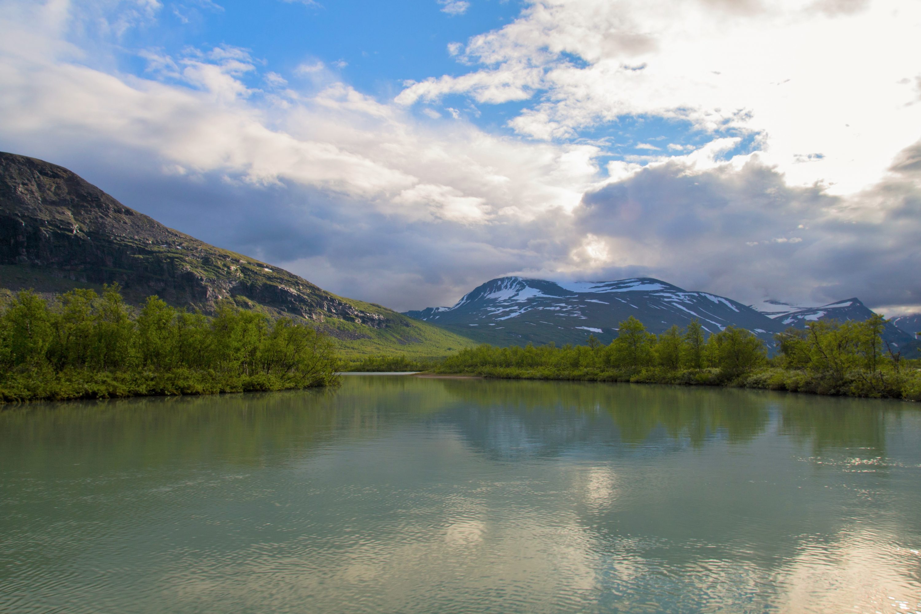
The first milestone for the day was the Tjäktja pass which was, apart from Kebnekaise, the only real climb during our hike. At the top of the pass, there was still quite some snow. From there, it was possible to go even higher. Some of us chose to stay and take a break while Bert, Kristof and I went up to the top for an even better view of the valley.

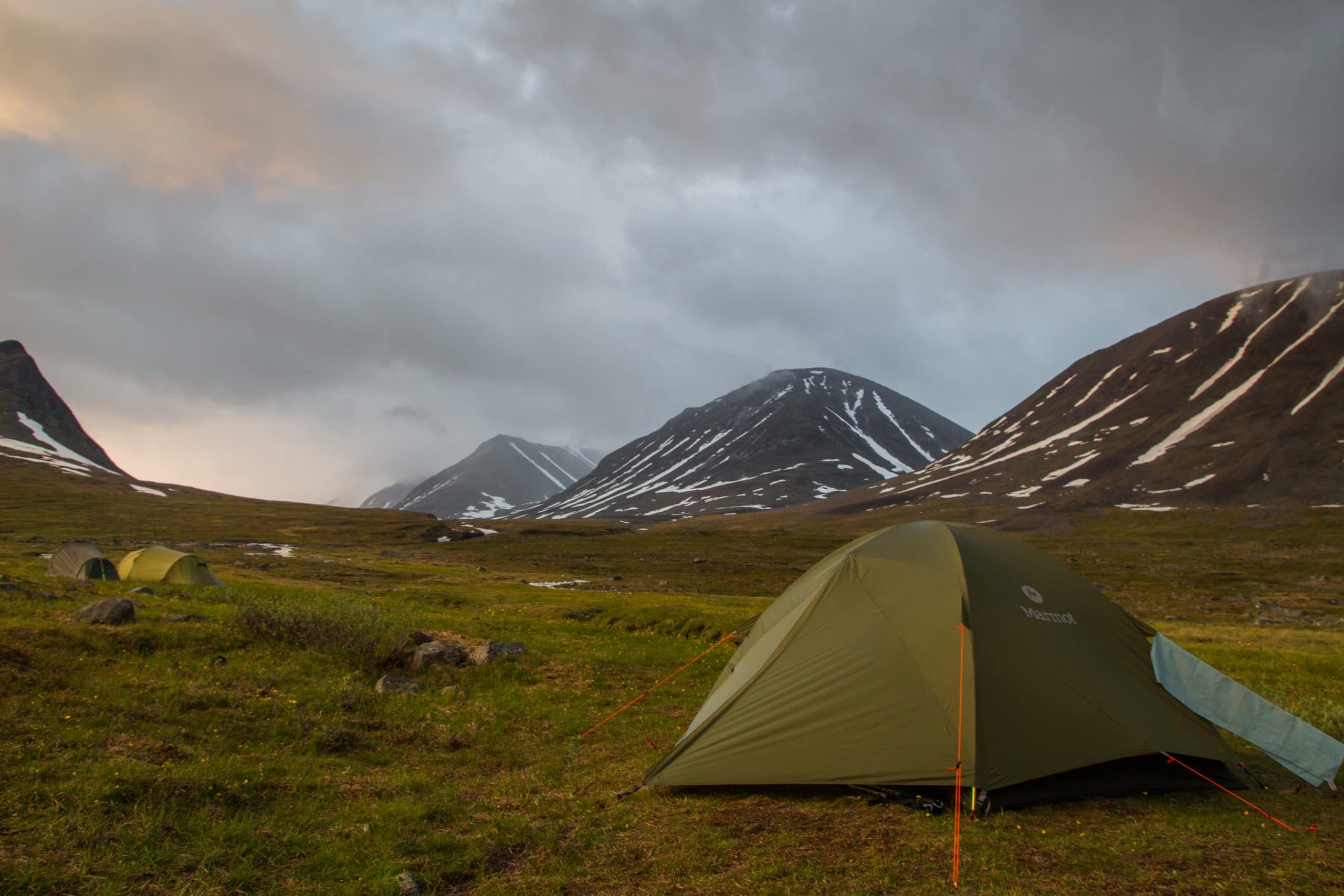
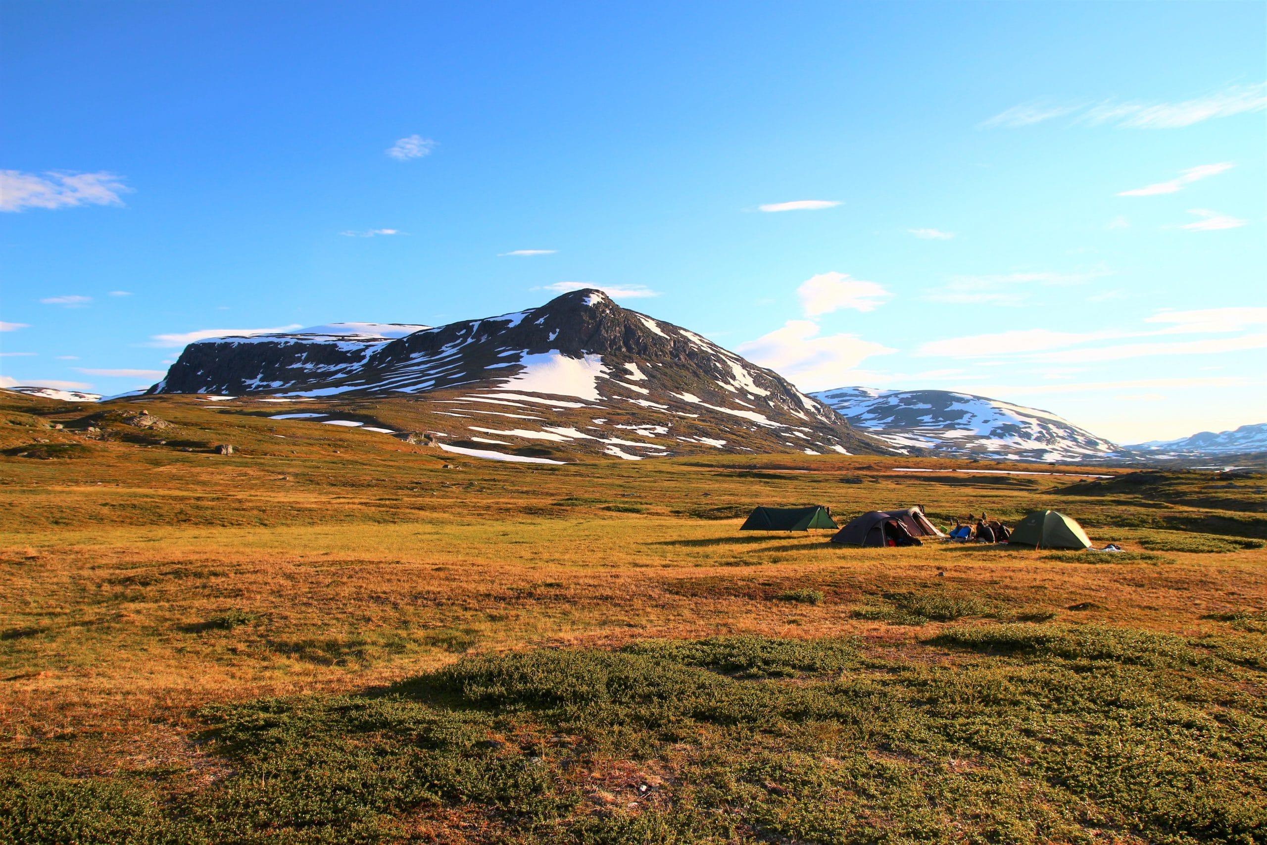
We descended back down on the other side. Here the trail wasn’t always clear and there was still a lot of snow. Now we were getting closer to the Tjäktja station. The initial plan was to stop there but Tine suggested we pressed on a little bit to find ourselves a place a couple of kilometres further down the trail. I was not sure this was a good idea.. but my mind changed when after 2 more kilometres we found the most beautiful camping spot I had ever seen.
In the 360° around us, there was nothing or no one in sight. The weather was still amazing and we had the best evening.
Day 6 (Tjäktja area – Alesjaure area)
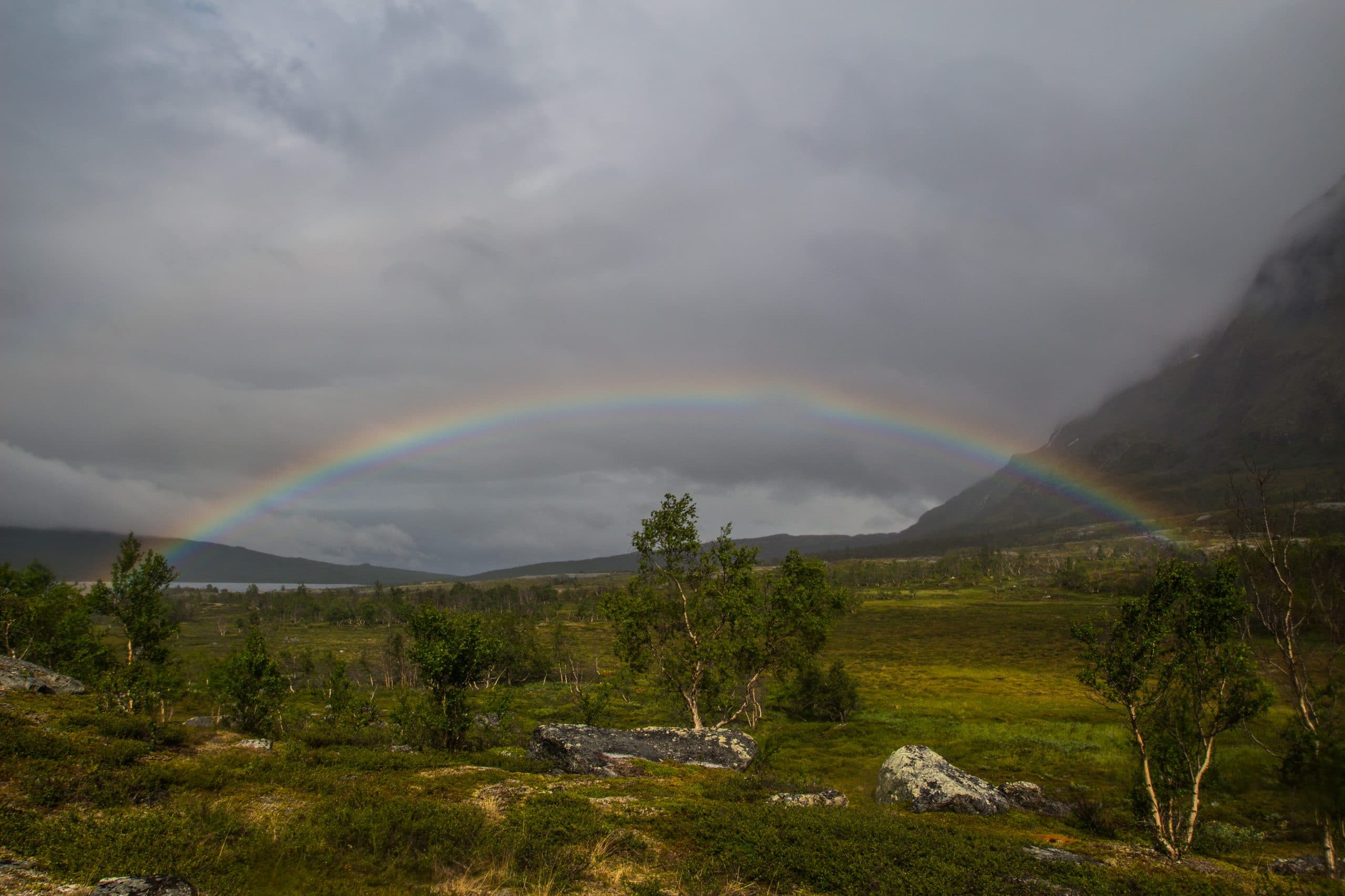
The next day, the good weather had disappeared.
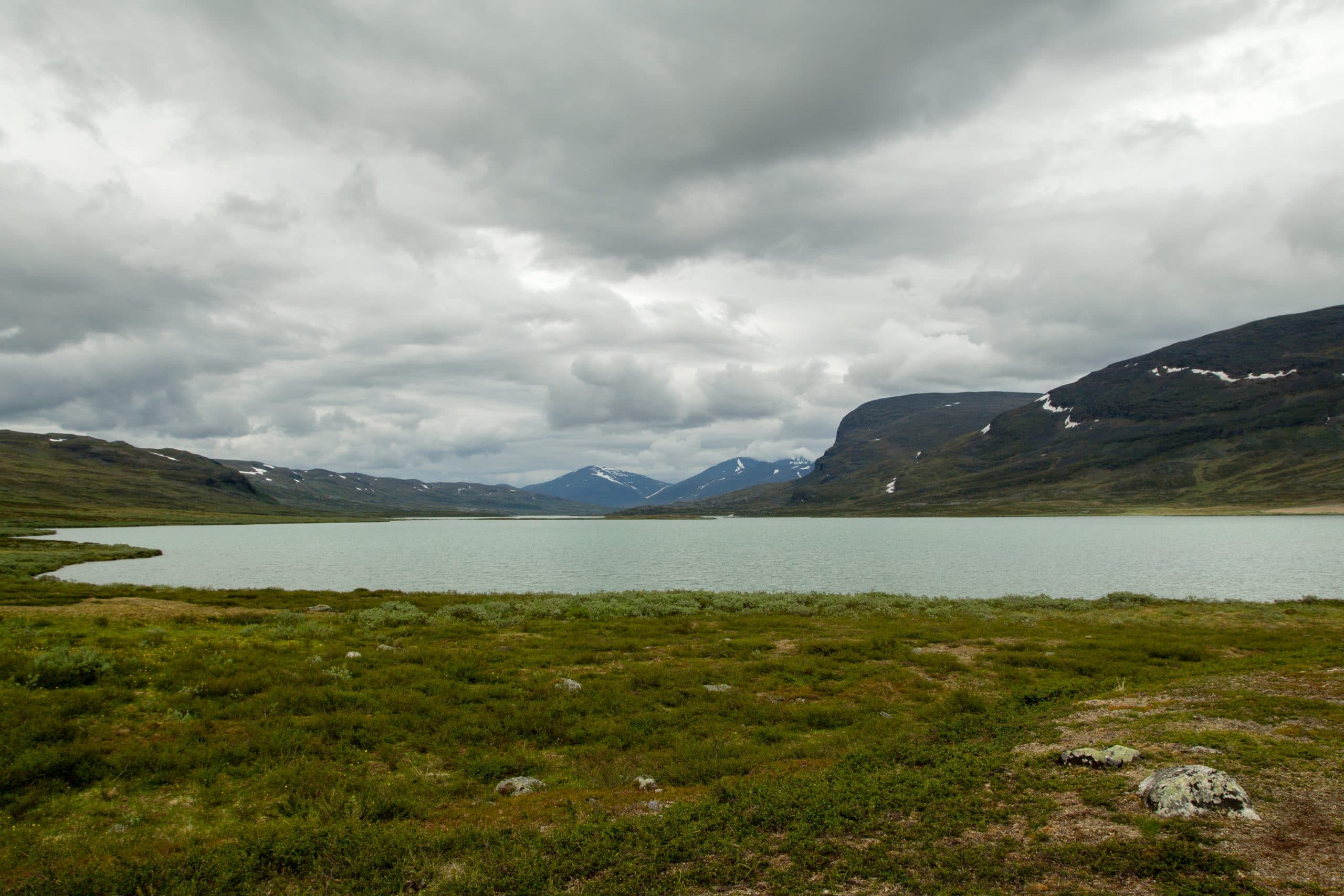
The first stop was the mountain cabin of Alesjaure. It was located on a hill and was next to the Alesjaure lake. On the other side of the lake we could see a Sami village.
After a while we started looking for a place to put up our tent. The area was pretty wet and mosquitos were everywhere but we had no choice. We couldn’t even stand still outside so we hurried to put up our tents and cooked our dinner inside.
Day 7 (Alesjaure area – Abiskojaure Fjällstuga)
The next morning we slowly started descending and for the first time in 5 days, trees started to appear again which created an interesting change.
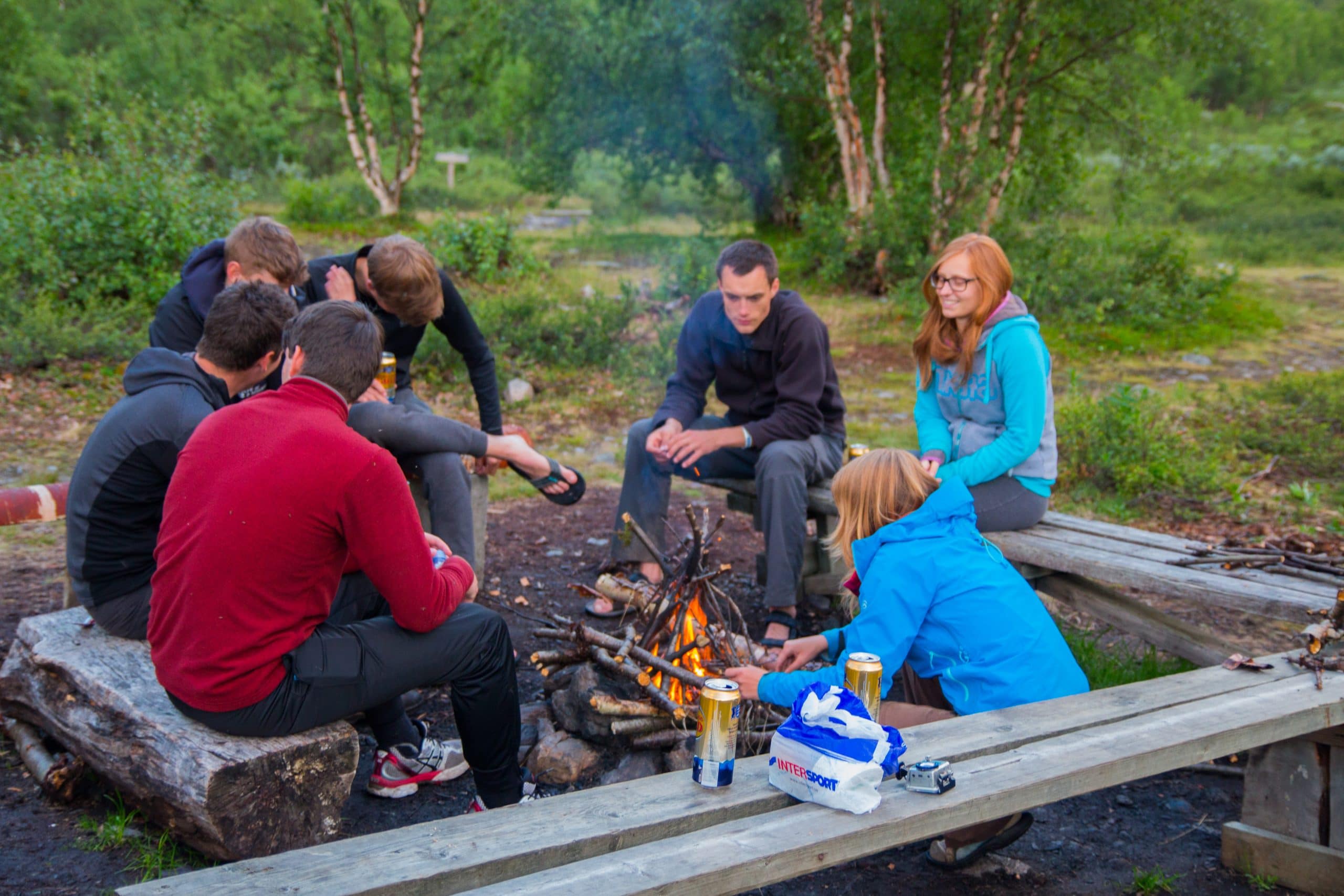
The camp for that night was at the beginning of the Abiskojaure lake. There was a big place available for tents and there also was a sauna and a small shop! We bought some beer and enjoyed our last night in the wild around a campfire.
Day 8 (Abiskojaure Fjällstuga – Abisko)
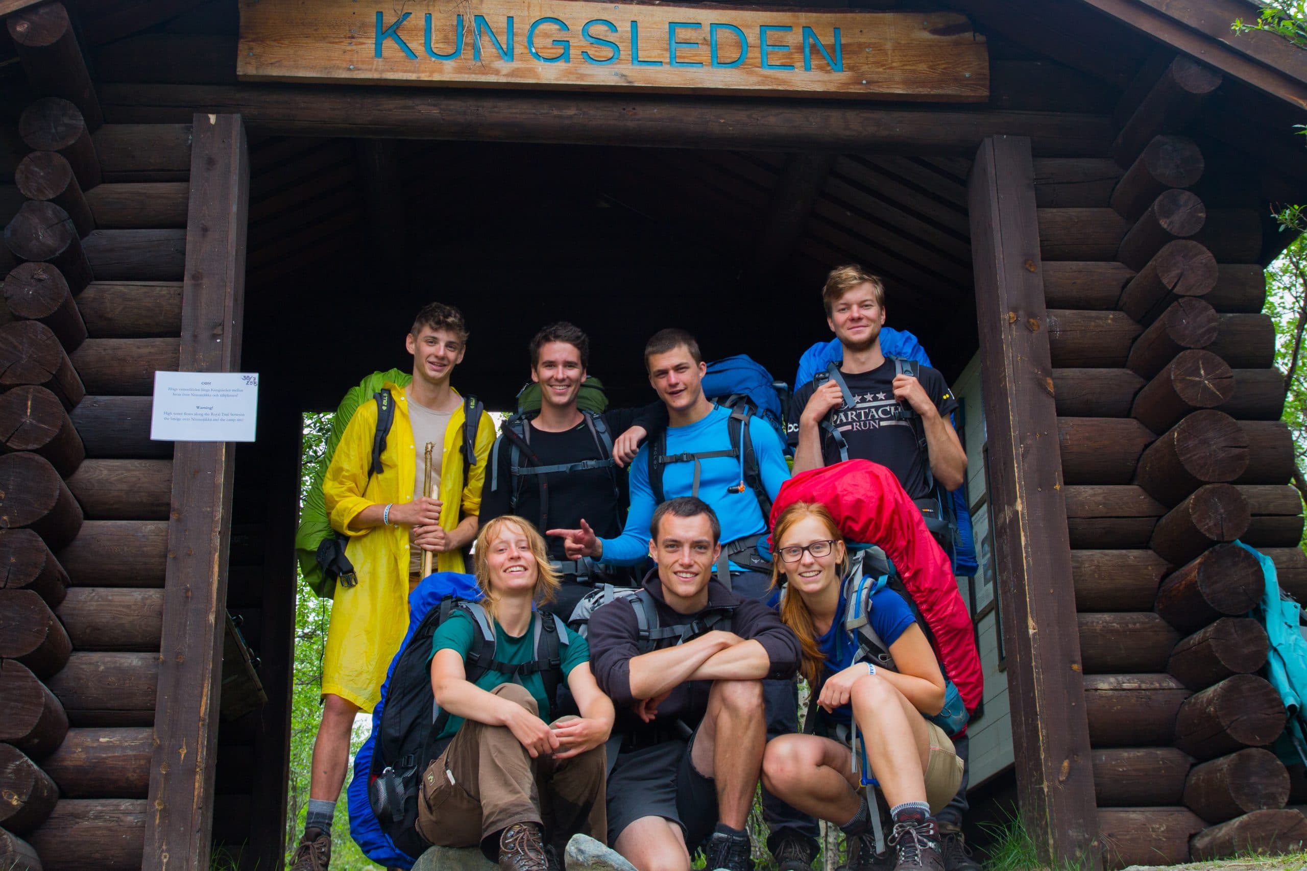
The last day we hiked along the lake Abiskojaure which turned into a big river after a while. This day was not really special and a typical last-day-of-the-hike. Once you pass under the wooden construction that marks the end (or start) of the Kungsleden, you are done. Finished!
From there we hiked a bit further to the STF Abisko Mountain Station. We got some food and I quickly found myself a hammock. PERFECT. When we had all taken a well deserved rest, we took the bus back to Kiruna. The next day we flew back to Stockholm.
After the hike
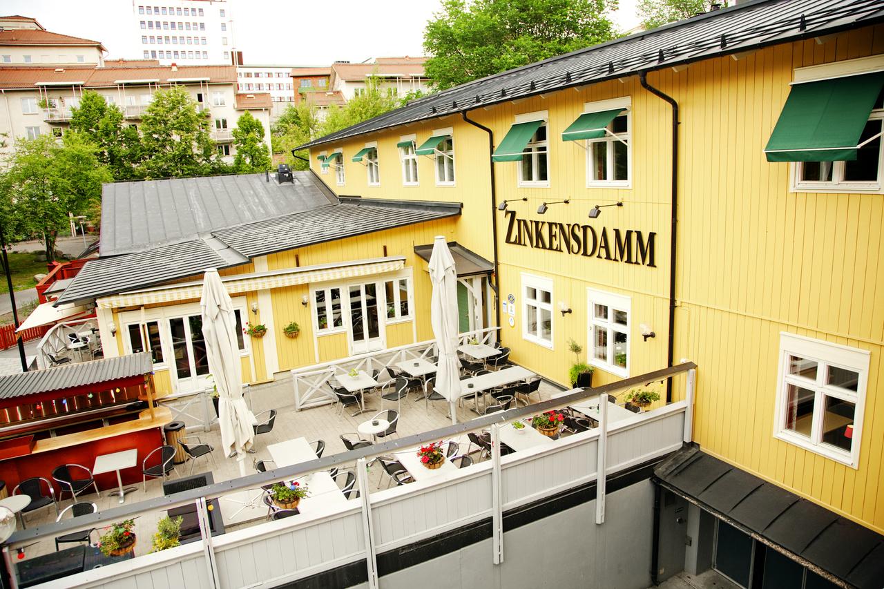
Once in Stockholm, we had booked a place in the STF Zinkensdamm Hostel. Because we all had a Hostelling International membership, we had reduction there! Good hostel, definitely would recommend.
We spend two more days in Stockholm. We hiked around the beautiful city (it is my favourite now), visited the Vasamuseum and went swimming in Långholmsbadet.
Practical information
Getting there
First we flew from Brussels Airport [BRU] to Bromma Stockholm Airport [BMA]. The next day we flew from Stockholm Arlanda Airport [ARN] to Kiruna Airport [KRN]. The second flight was definitely the more expensive one. It is also possible to get to Kiruna by night train, but flying worked better with our schedule.
From Kiruna Airport we took a bus to the bus station in Kiruna and from there a second bus that brought us to Nikkaluokta. After our hike, we took a bus from Abisko back to Kiruna and flew back to Stockholm the next day.
Sleeping before and after
Arlanda Airport
We hoped for a place to sleep for free and found what we were looking for easily. For more information on sleeping inside Arlanda Airport (for free), take a look at https://www.sleepinginairports.net/guides/stockholm-arlanda-airport-guide.htm
Stockholm
After our hike, we stayed in the STF Zinkensdamm Hostel. When you are member of STF or HI (Hostelling International) you receive a reduction here, as well as in all other STF mountain stations and huts.
http://www.booking.com/hotel/se/zinkensdamm.html
Mountain huts and stations
There are a number of huts on the trail. Click on the links below to find out about the provided services and facilities in each of them:
- Kebnekaise Fjällstation
- Singi Mountain cabin
- Sälka Mountain cabin
- Tjäktja Mountain cabin
- Alesjaure Mountain cabin
- Abiskojaure Mountain cabin
Maps
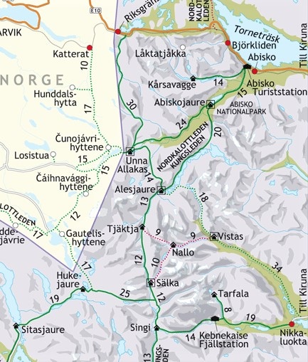
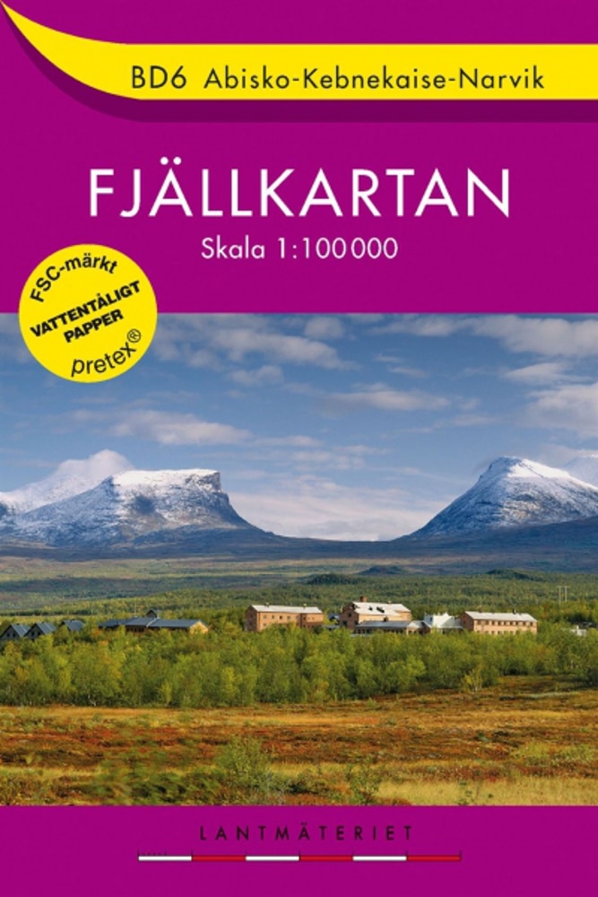
For navigation, we only used the Fjällkartan BD6 Abisko-Kebnekaise-Narvik (1:100 000). Despite the scale used on the map, it was perfect for this part of the Kungsleden. It is hard to make a big mistake because all you need to do is follow the valley.
Looking for a good map from an awesome local shop? Travel bookstore Atlas & Zanzibar (also supporter of this blog) probably has what you need (or they can get it for you)!
Fuel
Fuel is available in the Intersport in Kiruna at the following address: Föreningsgatan 4, 981 31 Kiruna, Zweden (5 minute walk from the main busstation).
Useful websites
- https://www.swedishtouristassociation.com
- http://www.caersbart.be/hiking/kungsleden-abisko-nikkaluokta/
- https://www.pietsmulders.nl/zweden_kungsleden.html
Route
The route displayed is not an actual recording of our hike. I reconstructed the route afterwards, so there may be small differences from the actual route.
If this article was useful for you, feel free to send me a cup of coffee! ☕
Prachtig! Bedankt om dit te delen. Jättebra!
Thanks, graag gedaan Lena! 🙂
Zalige trek, wij hebben hem al gedaan met Fjallraven. Een hele beleving die we graag nogmaals doen.
Zeker nu we je verslag zien…
Doen zou ik zeggen! Naast het stuk Nikkaluokta-Abisko is er nog een dikke 300 kilometer waar je kan aan beginnen 😉
Hey Wouter,
Thanks for sharing this information.
This hike is now on top of my list 🙂
Keep on blogging
Super! Thanks Chris! Looks like some interesting trips on your website too! (Montenegro and Cairngorms)