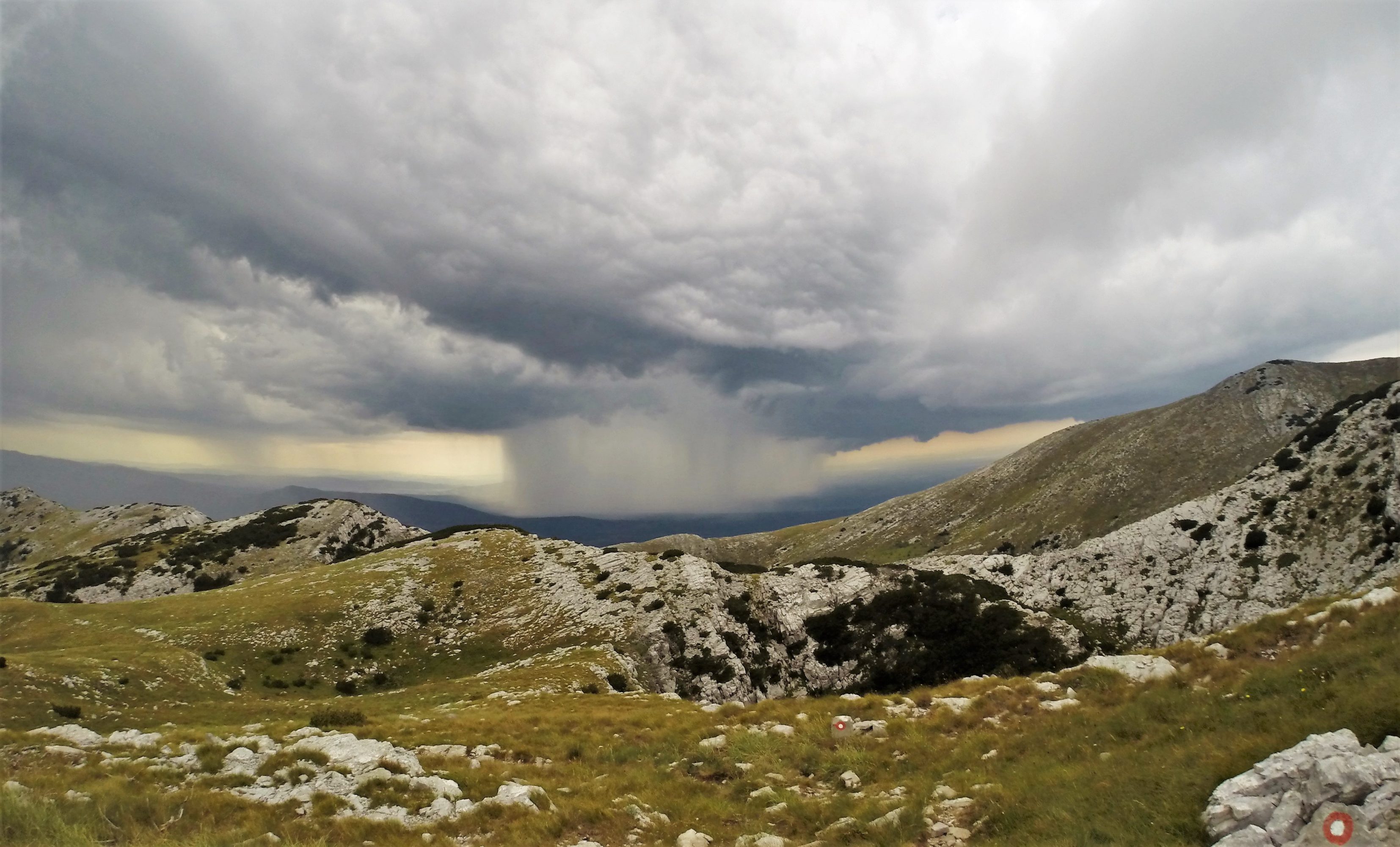
The Dinara offers a solid day hike through small bushes, mountain meadows and rocky terrain. On the summit you are rewarded with a beautiful view. The majority of the route is well marked and pretty straightforward but good orientation skills are welcome. On your way to the top you will pass a small fortress ruin and the entrance of a cave. Further, take into account that high temperatures and thunderstorms can occur in the summer.
In a nutshell
| Type of hike | 1-day hike |
| Start – Finish | Glavas (550m) |
| Ascent – Descent | [4u – 1281m up] – [2u30 – 1281m down] |
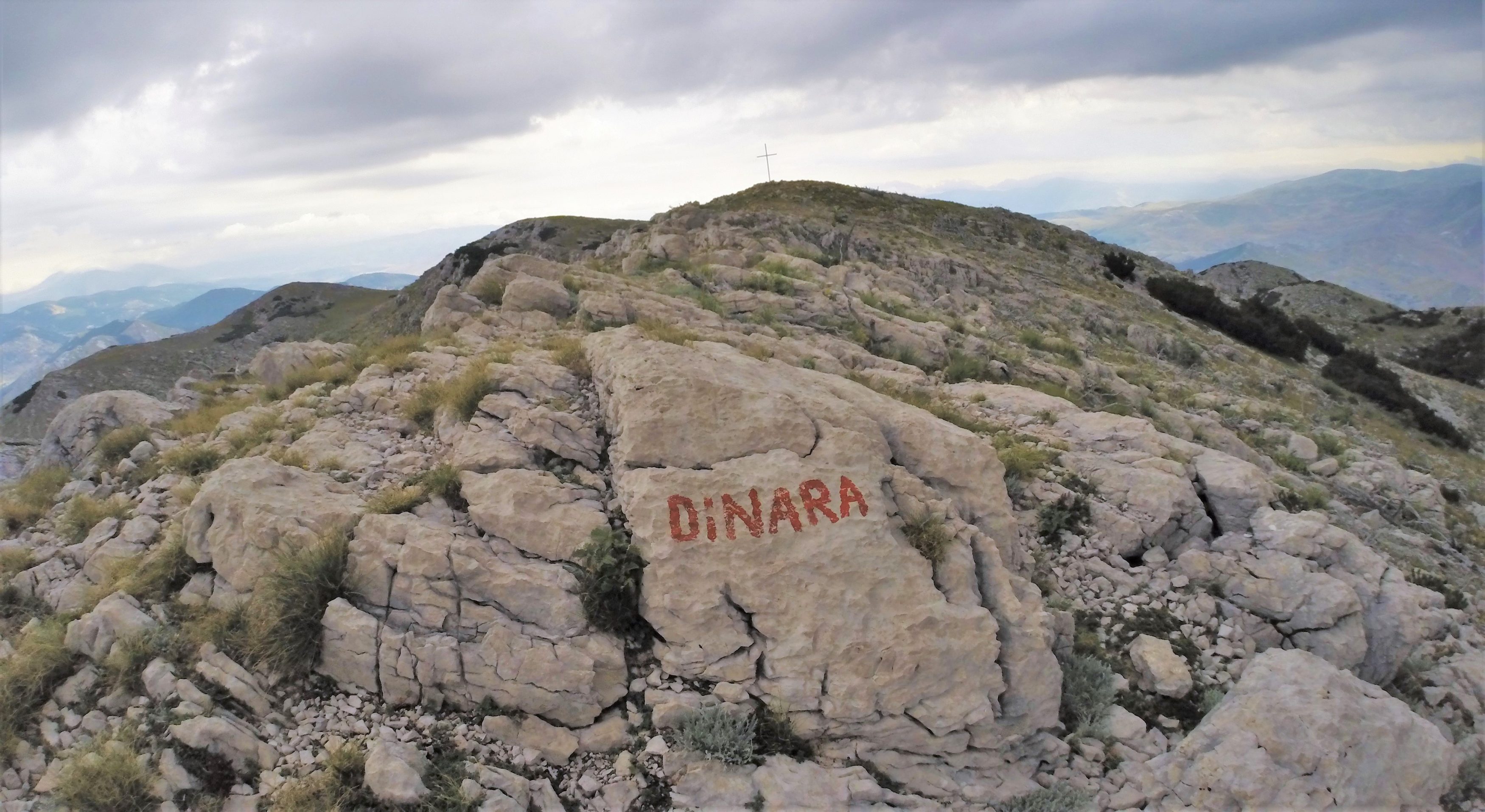
| Summit | Dinara (1831m) |
| Markings | Red circle with white center |
| Time of year | July 2016 |
| Location | Kijevo, Croatia |
Start & Finish
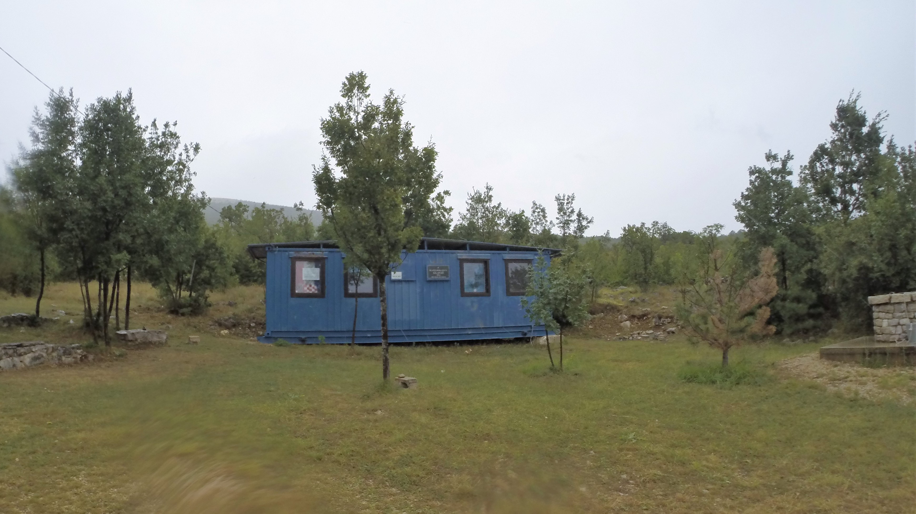
The route starts in Glavas, a town northeast of Kijevo on the route between Sinj and Knin. A small and free campsite (Planinarska kuća Glavaš), meant for hikers of the Dinara, can be found just outside of Glavas and marks the start of the trail. It is possible to park here.
The Climb
It is advised to leave early as temperatures can rise high above 30 degrees in the summer and there is little to no shade along the way.
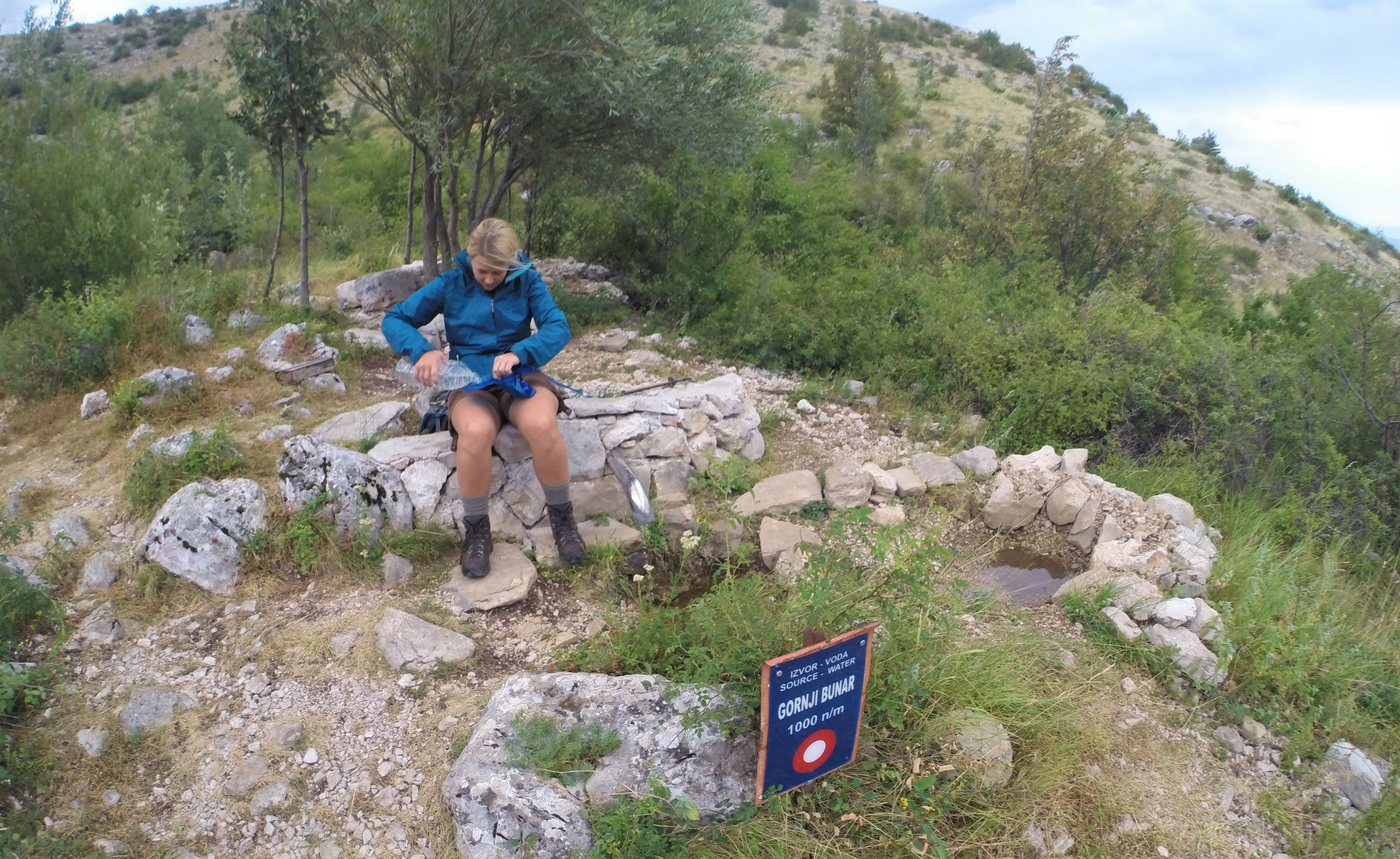
The route starts at a small campsite which is meant for someone like you, a hiker on his way to the Dinara. The campsite offers a well with fresh drinkable water and some wooden picnic tables. From here the route climbs northwest through small bushes to the ruin of an old fortress which you can already spot from far away. The path continues its way up through bushes further into the valley. A sign with ‘Pecina’ (825m) marks the entrance of the cave a few meters further up the hill. It’s definitely worth a visit on the way down. The bushes will become thinner and soon you are walking above them as the path starts to zig-zag its way up the mountain. At 1000m altitude a small well (‘izvor voda’ in Croatian) offers some welcome refreshments.
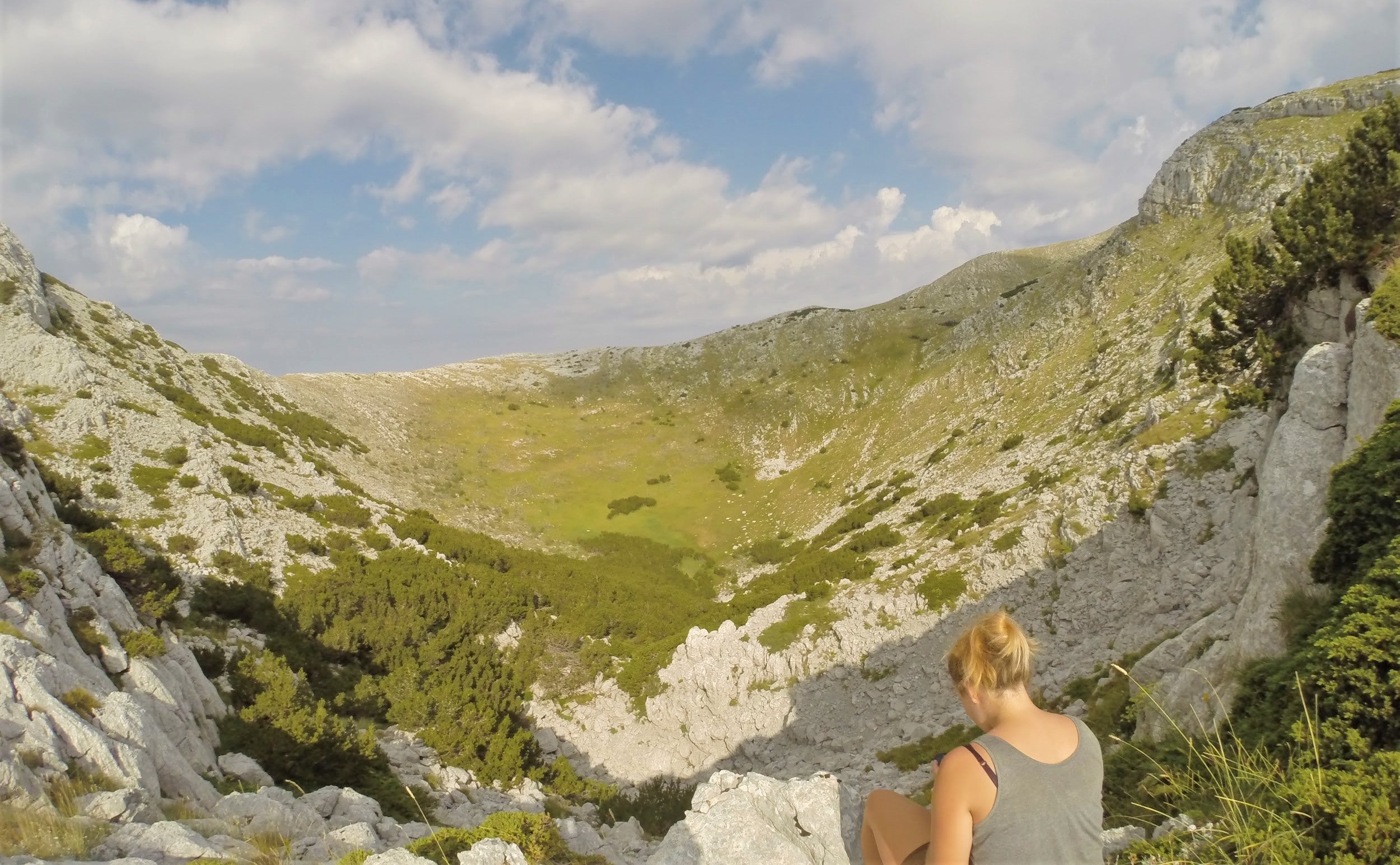
The route continues to climb and reaches a wide and open valley. The path splits halfway into the valley: one way is leading to a shepherd’s cabin (Martinova Kosara) and one leads you to the steeper west side where our climb continues. Take the path to the west. At 1375m, a second path coming from Martinova Kosara joins the route again. Ascent further northwest through a mix of pastures and rougher stony terrain. After a small forest, the path passes the side of a small craterlike valley (1650m) before making its way to the top.
The last section is less steep and full of small bushes. On the summit (1831m) you find a cross, plaque and stamp of the Dinara. Retrace your own steps on the way down.
Practical information
Maps
- ‘Smand 40 – Dinara’ (1/30 000 – 2011). Available in Alta Via (Antwerpen) or via http://www.smand.hr/.
Books
Sleeping
- Free campsite at the start of trail: Planinarska kuća Glavaš
UTM coordinates: 33 N 613801 4874117
General remarks
- Good map reading skill needed
- High temperatures and thunderstorms possible
- Normal hiking gear needed